Celebrate Adirondack Maps: Craftsmanship Meets Innovation
Explore the finest Adirondack Maps products crafted for quality, innovation, and style.
Lake Placid/high Peaks, Adirondack Park: Trails Illustrated Other Rec. Areas (National Geographic Trails Illustrated Map) Map – Folded Map, 2 Aug. 2012
L1,619

Saranac, Paul Smiths: Adirondack Park Map (National Geographic Trails Illustrated Map, 746)
L1,719
![Adirondack Park [Map Pack Bundle]: Trails Illustrated Other Rec. Areas (National Geographic Trails Illustrated Map)](https://m.media-amazon.com/images/I/81xmHcTIZxL.jpg)
Adirondack Park [Map Pack Bundle]: Trails Illustrated Other Rec. Areas (National Geographic Trails Illustrated Map)
L3,995

Lake Placid & Saranac Lake Cycling Map | Adirondacks Hiking & Trail Map | Cycling Routes from Paul Smiths to Keene Valley and Around Whiteface Mountain | Durable, Waterproof & Tear Resistan
L482

Lake George, Great Sacandaga: Adirondack Park Map (National Geographic Trails Illustrated Map, 743)
L466

Adirondack Region / North Country New York State, New York Regional Map
L964

The Trails of the Adirondacks: Hiking America's Original Wilderness
L2,319

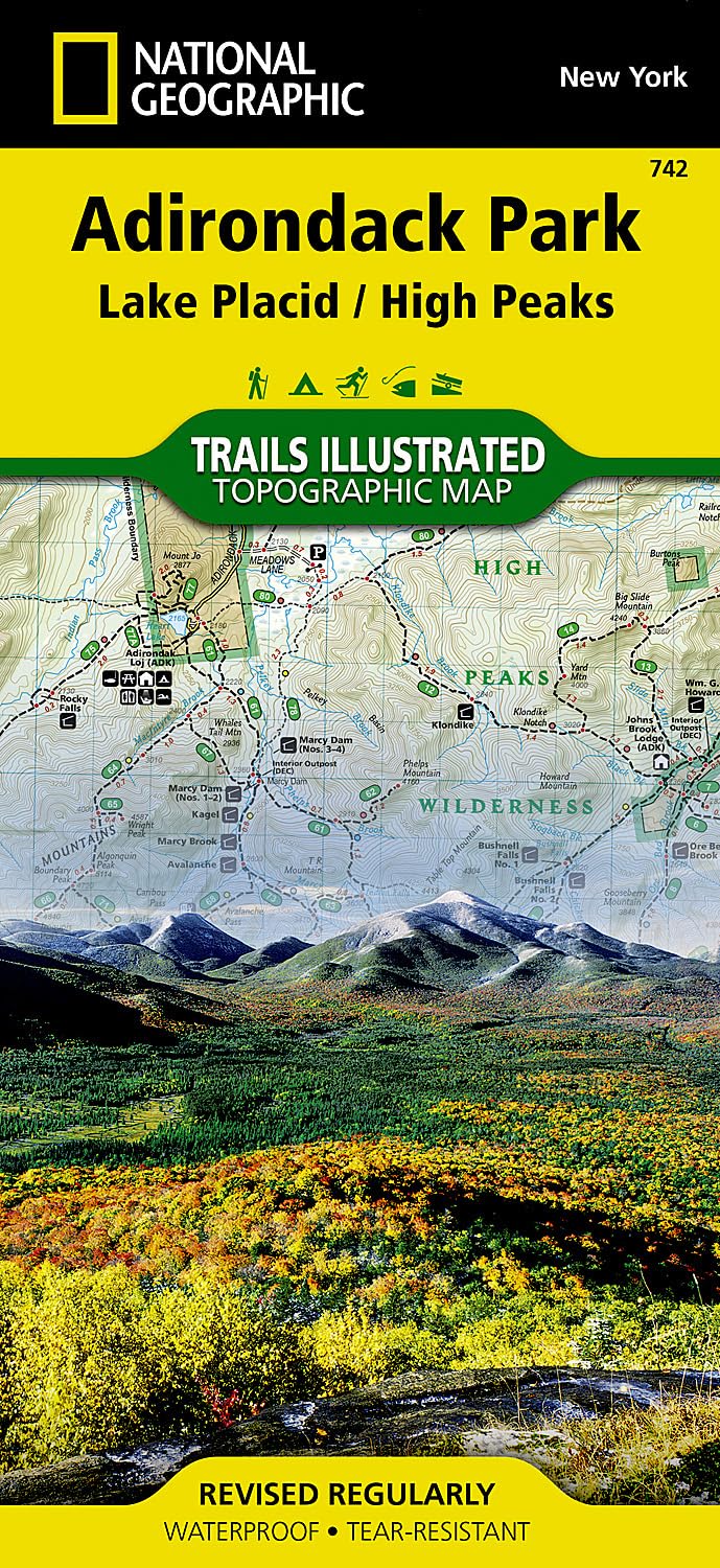
Lake Placid, High Peaks: Adirondack Park Map (National Geographic Trails Illustrated Map, 742)
L1,539

Old Forge, Oswegatchie: Adirondack Park Map (National Geographic Trails Illustrated Map, 745)
L464

Adirondack Park Map & Illustrated Trails: Guide to Hiking and Exploring Adirondack Park
L401
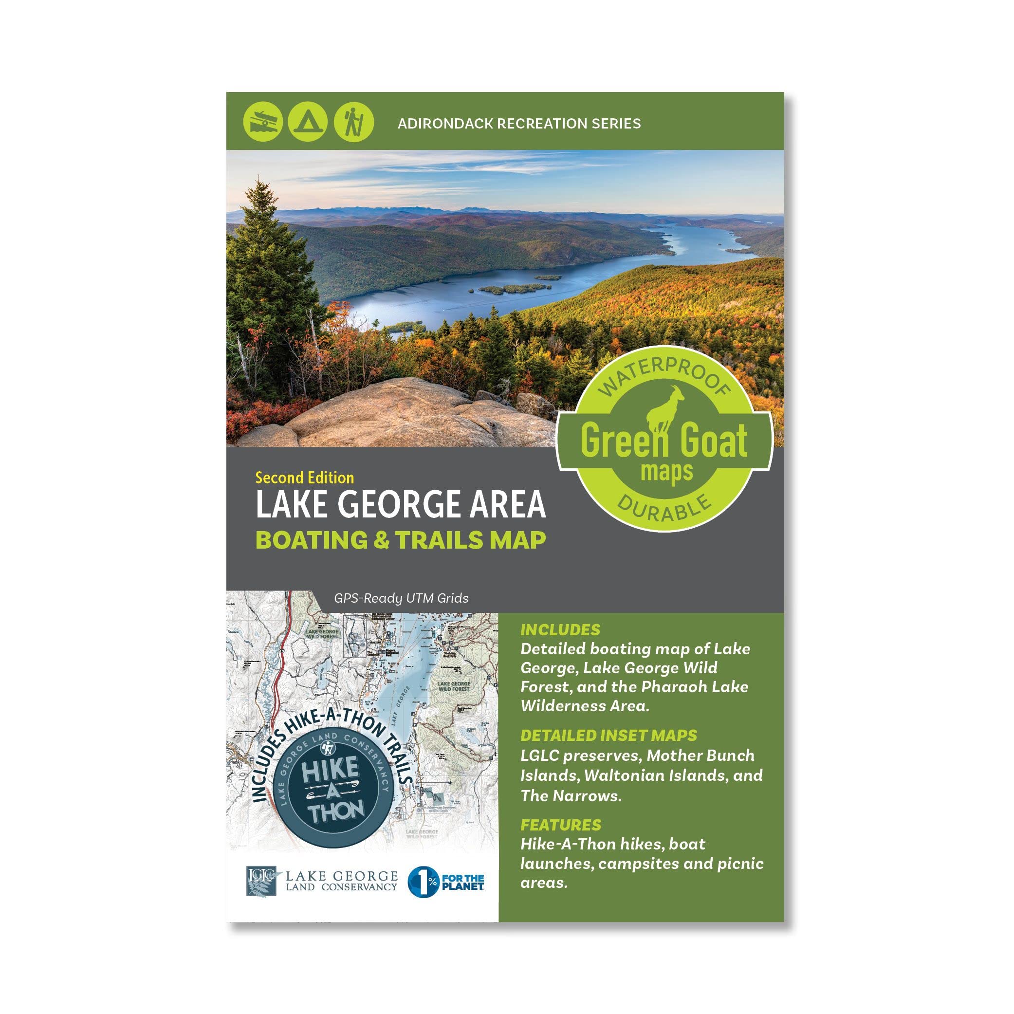
Lake George Boating & Trails Map | Adirondack Lake Hiking Map - Lake George, Paradox Lake, Schroon Lake, Brant Lake and Pharaoh Lake Wilderness Area | Durable, Waterproof & Tear Resistant
FREE

Exploring the 46 Adirondack High Peaks: With 282 Photos, Maps & Mountain Profiles, Excerpts from the Author's Journal, & Historical Insights
FREE

ADK Forty-Sixer: Adirondack 46 High Peaks Personal Logbook for Hikers!
L814

Northville, Raquette Lake: Adirondack Park Map (National Geographic Trails Illustrated Map, 744)
L401

The Opening of the Adirondacks: With a Map and Illustrations (Classic Reprint)
HNL564

Asher & Adams' New Map & Guide of the Hudson River, Adirondack and Catskill Mountains ...
L444

Ausable River Fly Fishing Map | Adirondack High Peaks Map - East Branch and West Branch | Includes Fishing Pools and Nearby Ausable River Hiking Trails | Durable, Waterproof & Tear Resistant
FREE

Best Easy Day Hikes Adirondacks, Second Edition (Falcon Guides Best Easy Day Hikes)
L1,499
![Adirondack Park [Map Pack Bundle] (National Geographic Trails Illustrated Map)](https://m.media-amazon.com/images/I/51PAzPrs0GL.jpg)
Adirondack Park [Map Pack Bundle] (National Geographic Trails Illustrated Map)
L5,349
![Report on a Topographical Survey of the Adirondack Wilderness of New York. [With a Map.]](https://images-eu.ssl-images-amazon.com/images/I/41BUvomIPLL.jpg)
Report on a Topographical Survey of the Adirondack Wilderness of New York. [With a Map.]
HNL844

Adirondack Trails High Peaks Region/with Map (Forest Preserve Series)
L1,695

Best Easy Day Hikes Adirondacks (Falcon Guides Best Easy Day Hikes)
HNL367

Adirondack Park Topo Map Pack National Geographic Waterproof Topographic Trail Maps New York Adirondacks
L1,716

Lake George Boating & Trails Map | Adirondack Lake Hiking Map - Lake George, Paradox Lake, Schroon Lake, Brant Lake and Pharaoh Lake Wilderness Area | Durable, Waterproof & Tear Resistant
L594
Adirondack Park Map & Illustrated Trails: Guide to Hiking and Exploring Adirondack Park
L363

South Pembrokeshire / De Sir Benfro Map | Pembrokeshire Coast National Park | Ordnance Survey | OS Explorer Map OL36 | Wales | Walks | Hiking | Maps | Adventure
L1,149

Adirondacks Vintage-Style Map Art Print Poster by Lakebound (12" x 18").
HNL1,419
Adirondack Region / North Country New York State, New York Regional Map
L399

Adirondack map: Campgrounds, golf courses, fishing sites, trail heads, ski areas, beaches, etc., detailed maps of Lake Placid, Lake George ... & others
L1,533

ADIRONDACKS TRAVEL GUIDE 2024: The Complete Handbook to Exploring Adirondacks Beautiful Sights, History, Food, and Culture.
FREE

Adirondacks Old Forge Area Outdoor Adventure Map | Old Forge Trail Map - Blue Mountain Lake NY | Includes trail maps of Fern Park and Maple Ridge Trails | Waterproof & Tear Resistant
L1,559

Best Maps Ever Adirondack Fire Tower Challenge Map 11x14 Print (Sage)
L1,479
Get the App